In real estate you have a three step process when evaluating environmental concerns during a property transaction. The three steps are summarized as follows:
Phase I: Historical research
Phase II Testing for suspect issues found from the Phase II
Phase III, commonly called remediation or corrective action.
Between Phase I, II & II, phase II is the most commonly misunderstood part and many people think you can combine a Phase I & II, which you can't. The reason being is you need to do the Phase I to draft a road map (navigate) more or less of issues with the property that you use the Phase II to actually quantify (quantitative data).
Let's have an example of a Phase II.
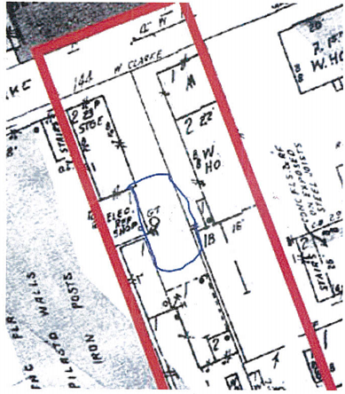
Phase I is performed of what the casual person would consider low risk. Multi story building with retain on first floor and residential units on higher floor. The Phase I review historical research (it is surprising what databases you can pull from for a property. A Phase I historical research includes evaluating Sanborn historic fire insurance maps (if available for a site). In a snippet from a Sandborn map for this site, the designation GT was noted. GT = Gasoline Tank.
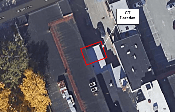
So you now compare the map with an overlay or aerial photographs to evaluate the location.
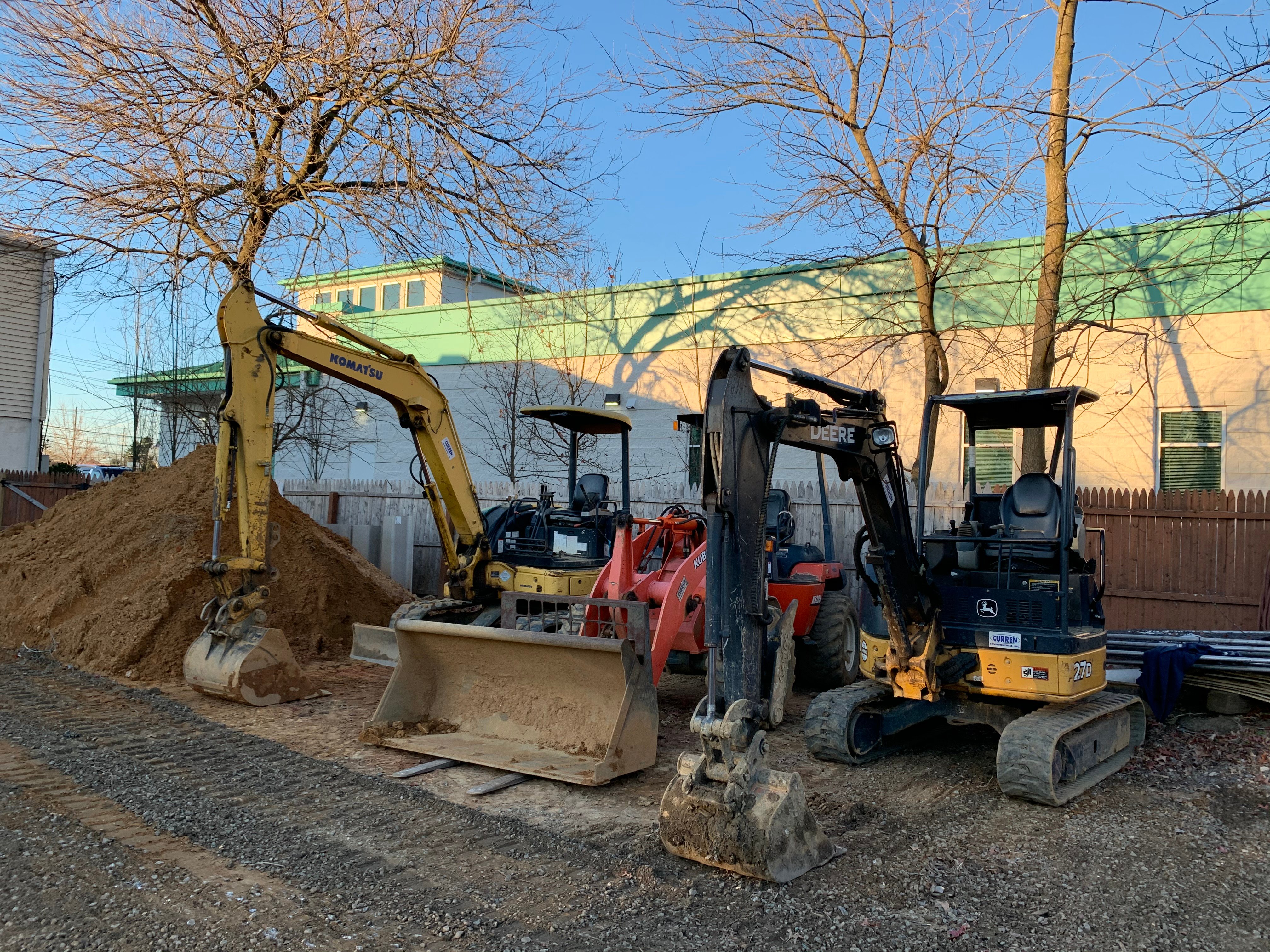
The Phase I consists of a walking inspection of a property, which you should not perform before you obtain and review your historical research. So in this scenario you would have reviewed the Sanborn map band noted the historic gasoline tank. Clearly when you do your walking inspection you evaluate this area as you have noted it through historical and current imagery.
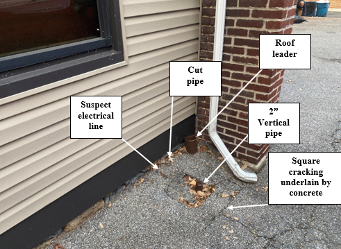
You can see from the photo of the area that there are still visual clues of the gas tank being present.
You are now moving forward with the Phase II as the gas tank may still be present or removed, it could be either. Bear in mind the current owner has been interviewed and has no knowledge of a gas tank.
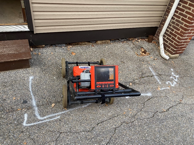
A common Phase II task is completed a Ground Penetrating Radar (GPR Survey). Ground penetrating radar (GPR) is a geophysical technology that uses radar pulses to image below grade (subsurface) objects. It is a non-intrusive and nondestructive method to look below the surface, so to speak. By using electromagnetic radiation in the microwave band, signals are sent into the ground and when the radar encounters a solid object (buried objects), the signal is reflected back to the antenna and interpreted.
The photo below shows a GPR unit accessing the area of the suspect tank.
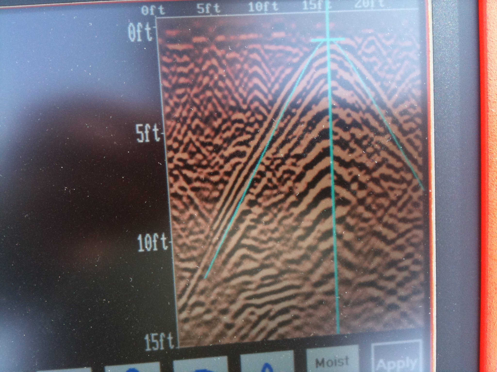
The image interpreted by the unit shows the reflection of a tank.
In this scenario, a mostly residential site had a Phase I performed, because performing a Phase I is SOP for commercial sites (the uninformed would believe a Phase I is not necessary). No one was aware a gas tank was present. The Phase I research pointed to a gas tank being present at one time. Property owner believed if a tank was present it was removed, I mean why leave the tank in the ground. A Phase II was performed (and no you don't commonly carry geophysical equipment when you walk a property doing a Phase I) and low and behold a gas tank was found.
To summarize, you do a Phase I to look for potential environmental issue. You do a Phase II to see if potential issues in the Phase I are issues. In this case the Phase II found a gas tank which will lead to a Phase III which would be tank removal.
Phase II Questions?
888-301-1050